Naaman, Mor and Song, Yee Jiun and Paepcke, Andreas and Garcia Molina, Hector (2004) Automatic Organization for Digital Photographs with Geographic Coordinates. Technical Report. Stanford.
![[img]](/style/images/fileicons/application_pdf.png) 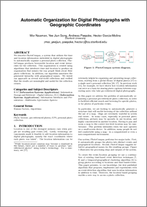 Preview |
| PDF
424Kb |
Abstract
We describe PhotoCompas, a system that utilizes the time and location information embedded in digital photographs to automatically organize a personal photo collection. PhotoCompas produces browseable location and event hierarchies for the collection. This organization is created using algorithms that interleave time and location to produce an organization that mimics the way people think about their photo collections. In addition, our algorithm annotates the generated hierarchy with geographical names. We tested our approach on several real-world collections and verifed that the results are meaningful and useful for the collection owners.
| Item Type: | Techreport (Technical Report) |
|---|
| Uncontrolled Keywords: | Photo browser, geo-referenced photos, GPS, personal photo collection |
|---|
| Subjects: | Computer Science > Digital Libraries |
|---|
| Projects: | Digital Libraries |
|---|
| Related URLs: | Project Homepage | http://www-diglib.stanford.edu/diglib/pub/ |
|---|
| ID Code: | 673 |
|---|
| Deposited By: | Import Account |
|---|
| Deposited On: | 03 Feb 2004 16:00 |
|---|
| Last Modified: | 23 Dec 2008 09:09 |
|---|
Available Versions of this Item
- Automatic Organization for Digital Photographs with Geographic Coordinates. (deposited 03 Feb 2004 16:00) [Currently Displayed]
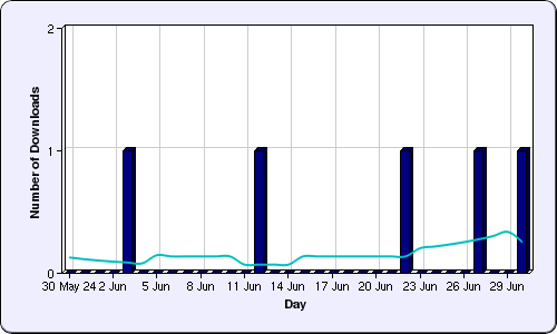
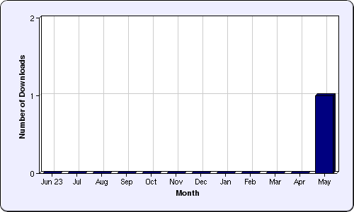
Download statistics
Repository Staff Only: item control page